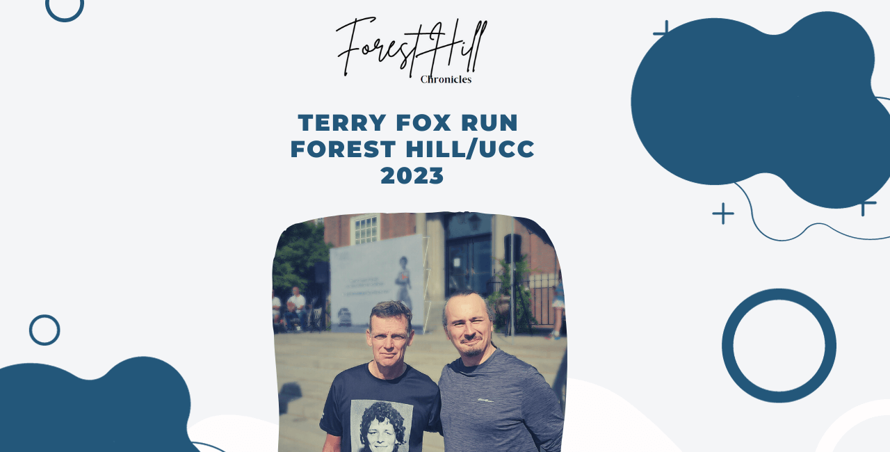
I jog every day on the Kay Gardner beltline. I wish I could go all the way but I limit myself to 5km each time. So far, I’ve been doing it successfully daily. During winter (there’s another part) I need to improvise as most part of the track is covered by ice. I was also happy to find out that the majority of the 10k and 5k Terry Fox Marathon in Forrest Hill was also on the same track. I’ve seen some commemorative stones which consisted of the name of the person and the fact that they ran this line for 40+ years and I told myself that must be nice and could be a goal.
I’m not the only one who loves this and I was pleasantly surprised to find this video that I share here. A lot of useful information and history from CJ Hoyle. It was recorded during the pandemic so you can only imagine how a simple walk like this could make a difference in one’s life.
Here’s the transcript of the video. Enjoy and thank you CJ Hoyle for this great video.
Hey this is CJ Hoyle today is Tuesday the 25th of May 2021 and I’m coming to you here from the western terminus of the Kay Gardner beltline trail in this video I’m going to be giving a narrated tour of the full Kay Gardner beltline trail starting from this end and going all the way to Mount Pleasant Road just sort of on the other side of that fence that was beside me when I was getting started.
On my left, that’s the Allen Expressway which also carries the line one subway line between Eglinton West station and the next one which is north of there which is called Glencairn and this trail that I’m riding on is on the former bed of the beltline railway which was built back in the 1890s it was completed in 1892 and it only ran successfully as a passenger rail service for two years before it closed proved to be unsuccessful.
We’re just crossing a road up here called Old Park Road – I’ve gotta wait my turn between these garbage trucks.
And now I can continue my way along the trail.
So I made a video earlier this year back in February where I travelled along the same trail that I’m on right now and I did it in the same direction but the difference between then and now was that back then it was covered in snow and I travelled this trail on my cross-country skis so I decided it might be fun to come out here now that summer is just around the corner and we’ve got lots of green growing everywhere I thought it’d be a good opportunity to show what it looks like now.
I did the same thing with another one of my cross-country skiing videos when I skied back at Cedarvale Park I came back about a month ago or so and I rode my bike through the same path of Cedarvale Park.
cedarvale park is actually sort of just a little bit south of where my starting point was for this ride here and this trail and that part kind of connect up together nicely – I wanted to do some kind of a loop you could combine those two together.
All right so we’re here at Bathurst street which is a fairly busy street and we need to get across it we’ll wait patiently for a turn to get across this first lane here and looks like there’s a nice gap in the traffic here for me to cross the second part and this neighbourhood that I’m passing through here is known as Forest Hill North I think – that’s what they call the area of land that sort of north of Eglinton because south of Eglinton is just called Forest Hill.
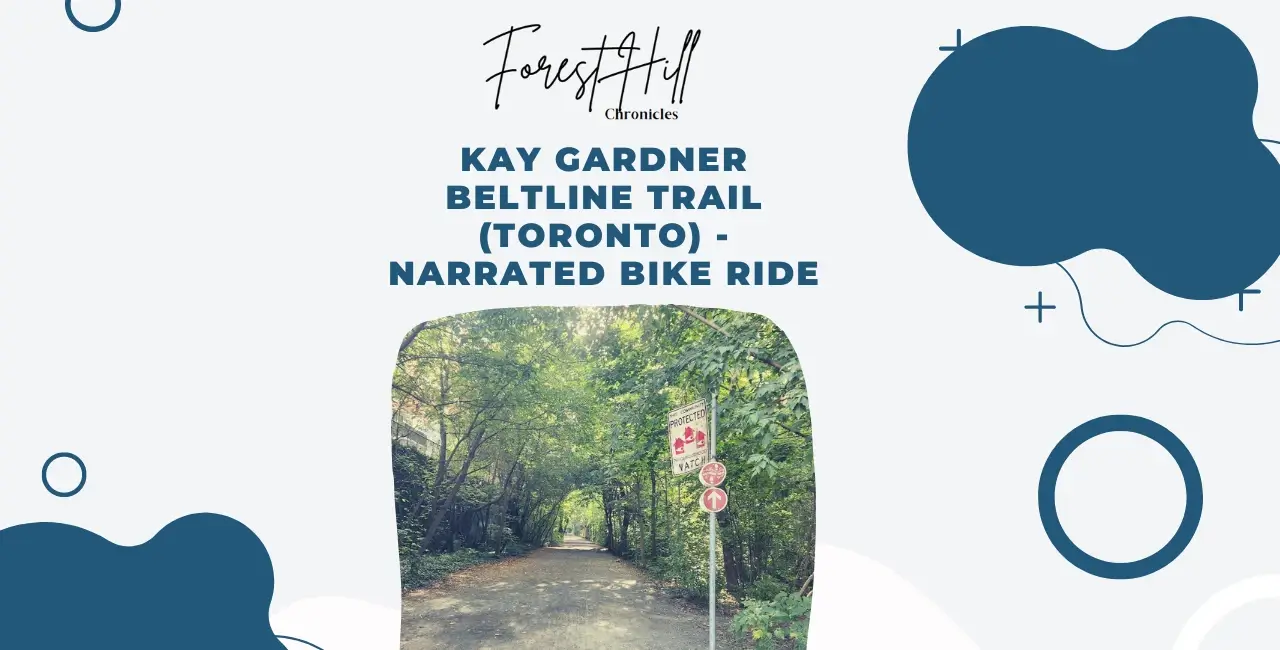
So unlike a lot of Toronto multi-use trails, this one is not paved, it’s made of the surface is made up of hard-packed gravel very fine crushed sort of limestone gravel and I’m not sure whether they’ve ever really considered paving it or not a lot of people use this for jogging on I think the joggers prefer a softer surface.
This trail was first built back in the 1980s and 90s that’s when they converted it from a railway into a trail so I guess at the time you know like they’re kind of new to making multi-use trails like this so I guess paving it wasn’t really something that they would have thought of whereas today you know any multi-use trail that you would build you think any new trail you’d build would generally it at least in an urban you know environment like this you’d probably pave it but I guess this trails you know sort of was designed back then and it’s just sort of they’ve kept it that way.
So this bridge we’re about to go underneath Eglinton Avenue so the Kay Gardner beltline trail and Eglinton Avenue kind of don’t quite go parallel to one another.
Eglinton avenue kind of goes due east west where this portion of the beltline kind of is kind of a little bit of a slope sort of sloping to the south as you head in the east direction like i’m going right now.
This here is one of my favorite portions of the beltline because there’s quite a long distance between that last crossing of Bathurst street and the next crossing which is up ahead.
That is one of the sorts of unfortunate things about this trail compared to other trails in the city like for instance the waterfront trail which is pretty much continuous without any interruptions there are these crossings every now and again where you do have to sort of stop and yield to the traffic and other activity that’s crossing your path. They’ve never built any bridges over a lot of these crossings there is one bridge on this trail that we’ll be crossing later but most of them are just level crossings of where the train used to be.
And of course, i’m speaking just of the Kay Gardner beltline trail there is an extension of it which goes in the west direction from where I started there’s sort of a gap because there’s you know there’s that highway that’s right there but on the other side of there is um the York belt line trail which goes in the other direction and it was built later and it’s a paved trail.
And it has some over-bridge crossings at least one, might have more that’s a trail that I’ll definitely have to visit sometime and make a video riding on that as well.
so you can see there are lots of people out enjoying the trail today i think the temperature when I left home said 28 degrees celsius it doesn’t quite feel that warm but I guess there’s a little bit of a prefetch but definitely lots of people out enjoying this.
As you mentioned I’m filming this at about 5 30 or 6 o’clock in the evening on a Tuesday sort of late afternoon. I usually film my videos my bike riding videos like this on weekends but I didn’t get a chance to film one this past weekend and it was actually a long weekend so today is a Tuesday but it feels a lot more like a Monday because yesterday was the May 24th or Victoria Day holiday.
All right we’re just about at our next crossing which is Avenue Road and this one actually has a signalized crossing and I think I’ll be able to make it before the traffic light changes I’m just looking at the countdown timer and yet 14 seconds – should be able to make it across here.
And yeah lots of people out enjoying this trail I would say if I were to have come here on the couple on the weekend you know on a Saturday or Sunday it would have been even busier than this, particularly in the summer when it’s you know really hot.
Another nice thing about this trail is that it has a lot of tree coverage which means that it’s usually shady if you come here on a really hot summer day it’s you know unlike the waterfront trail that I was mentioning earlier that’s very much exposed and you know you definitely would, would feel the heat or feel that the rays of the sun if you came here on a very sunny day where there is at least shady; although another benefit of the waterfront trail is that it’s it was…..
My chain fell off let me just put that back on hang on a sec…..
Sorry as I was saying there another benefit of the waterfront trail is that because it’s down by the water they’re usually it’s usually windier and it’s usually colder there so it’s also a great place to go I have made videos riding along the waterfront trail.
So that road we just crossed back there was Oriole Parkway and it’s a relatively busy road at least a little bit south of there and that’s because Avenue Road which is sort of a major north-south arterial it’s briefly interrupted because of Upper Canada College and to get around UCC it sort of route that the drivers and the other vehicles would go on to Oriole Parkway for a short stretch before rejoining Avenue Road.
I made a video showing Avenue Road a little over a year ago.
All right got another minor street here to cross.
So up ahead we’ve got our sort of the last crossing of a major road that we’ll be doing in this video and that’s Yonge street but it does have a bridge over the top of it that’s the one crossing that has a bridge on the Kay Gardener beltline trail and when I made my cross country skiing video that’s actually where I ended the video.
And I didn’t actually intend for that to happen I planned on riding all the way to Mount Pleasant or skiing all the way to Mount Pleasant but uh with my camera set up I ended up pressing a wrong button and it ended up having the camera facing in the wrong direction so all my footage for this last section up ahead was not used so I ended things a little bit shorter over here instead.
So we’re just crossing first of all the Yonge subway trucks and now right now over this wooden portion here we’re crossing over Yonge street itself and over on our left, there’s a row of apartment buildings and condos and to our right is the Mount Pleasant cemetery and there’s an entrance into the Mount Pleasant cemetery that cyclist wearing black – he’s just going into the cemetery there.
The Mount Pleasant cemetery is quite a large cemetery that’s sort of right in the middle of the city and it’s known for being a nice place for people to come and do outdoor activities. I know that’s not what people typically think of when they think of a cemetery but it really is you know a very sort of green park-like kind of an atmosphere with lots of roads and you know not a lot of traffic so it’s a place that people come to you know spend their time outside to go jogging or bike riding with the kids or rollerblading or whatever.
At some point in the future, I probably will make a video riding my bike through Mount Pleasant I’m not exactly sure how I would do that because or exactly sure how I’d structure that video because there are an awful lot of roadways in there and I would never really be able to show all of them in a single video but maybe I would just sort of ride from one end to the other and then come back along the other side or something like that.
Mount Pleasant cemetery actually runs all the way from Yonge street where it started back there all the way to Bayview Avenue. The Kay Gardener beltline trail only goes as far as Mount Pleasant but Mount Pleasant is actually the sort of center divider of it and the cemetery actually continues over on the other side of Mount Pleasant road.
There’s a little bit of downhill here and that blue mural that you can see straight ahead that’s the bridge for Mount Pleasant road and that’s where the Kay Gardner belt line trail ends.
If you ride through the cemetery though there is another portion that picks up on the other side that goes down through the Moor park ravine I’m not going to be riding that today.
So anyway, I hope you enjoyed joining me on this narrated tour of the Kay Gardner beltline trail if you watched all the way to this video I’d love to hear your thoughts in the comment section below and thanks for watching.